Grants :: Small Grant Facilities :: Biodiversity Assessment and Ecological habitat mapping of environmentally sensitive sites at Huvadhoo Atoll
Biodiversity Assessment and Ecological habitat mapping of environmentally sensitive sites at Huvadhoo Atoll
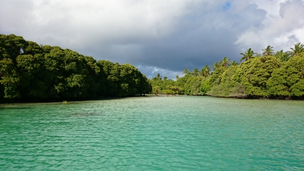
G.Dh Dhigulaabadhoo, G.Dh Dhigulaabadhoo © Abdulla Adam
Objectives
Objective 1 - To assess the biodiversity of the environmentally sensitive habitats
Objective 2 - To develop and prepare management plans for the identified environmentally sensitive
sites
Background
Develop detailed ecosystem and biodiversity assessment reports based on field surveys for Gdh.
Laabadhoo. Use the out puts of the assessment to prepare and develop management plans for the
selected sites under the project. The management plans will be submitted to relevant national institutions
for considering implementation.
Target beneficiaries
Benefits: Efforts by the government of Maldives improved towards biodiversity conservation in achieving the national commitments towards achieving Convention
on Biological Diversity (CBD).
Assist EPA in categorisation of Marine Protected Areas (MPAs) such as IUCN protected area categorisation
Enrich the knowledge of biodiversity in the Maldives and especially in Huvadhoo Atoll through detailed biodiversity assessment planned in this project
Beneficiaries:Local Stakeholder (Huvadhoo Atoll), EPA, MRC and The government of Maldives
Outputs
1. Stakeholder Analysis and Consultations
A thorough stakeholder analysis will be conducted to identify all relevant stakeholders for the project. These stakeholders will then be consulted prior to the assessments and during the assessments.
Relevant available data will be identified through these consultations
2. A full inventory of the different types of flora & fauna including Fish, Bird, Invertebrates, Mammals, Reptiles and Pests/Invasive Species, trees, shrubs, mangroves will be conducted.
Each inventory will be carried out by a specialist on the particular flora/fauna. The inventories will include all the different species identified under each category
3. Land and marine surveys will be conducted using instruments such as GPS, underwater cameras, binoculars etc. Field guides will be used as references.
The surveys will be conducted by qualified marine biologists and land surveyors
4. GIS Mapping: The mapping will be conducted by a GIS expert. This activity will involve the mapping of the different types of for a fauna, the topography of the island etc. This mapping would also show the most sensitive areas, and most vulnerable areas to natural hazards etc..
This will also help in determining the areas that need to be designated as environmentally protected areas
5. Based on the findings and well-practiced management plans for environmentally sensitive areas (ESAs), the experts will formulate the management plans for the identified ESAs.
6. Preparation of Management plans: The management plans will be presented to the key stakeholders and other environmental NGOs actively involved in conservation and protection of ESAs.
7. Conduct Training Workshops: The workshop will be conducted in a way to teach and train the participants on the importance of ESAs and how to manage such areas
Contributions to cross-cutting themes
Action on Climate Change, Natural Resource Management
Project Facts
Country
Location
G.Dh Dhigulaabadhoo
Topic
Duration
17th Feb 2017 to 20th Jan 2018
MFF Grant Amount
MVR 375,000
Co-financing Partner
Small Island Research Group (SIRG)
Implementing Partner
Environmental Protection Agency (EPA), Marine Research Centre and project REGENERATE (IUCN)