Grants :: Small Grant Facilities :: Status of shelterbelts along India’s southern coast
Status of shelterbelts along India’s southern coast
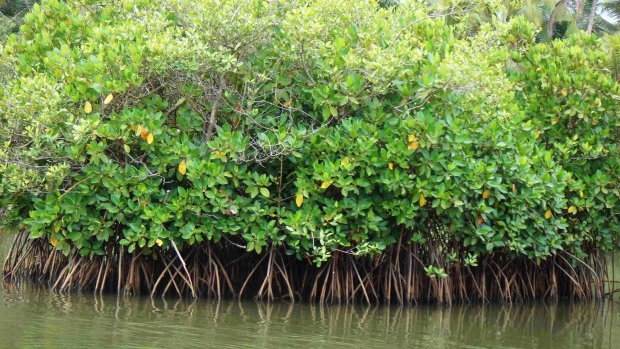
Rhizophora in Kunhimangalam, Kerala, India © Sourav Singh Deo, 2008
Objectives
This Environment Protection Training and Research Institute (EPTRI) project aimed to collate secondary information on the status of coastal shelterbelts in southern states of India, and to prepare a comprehensive synopsis of the initiatives undertaken by states to conserve and restore coastal shelterbelts in line with their strategies for promoting investment in coastal ecosystems. The project also undertook mapping of shelterbelts and other coastal habitats.
Background
Over three-quarters of the population in the surveyed states live along the coast, putting great pressure on ecosystems there. These coastal zones are also vulnerable to extreme weather events.
In an effort to minimize the loss of coastal habitats, human lives and property, state and non-state actors have created green belt buffer zones, also known as shelterbelts or “bioshields”, along the coast. These consist mainly of mangrove or Casuarina plantations, designed to augment the remaining natural forest and absorb or deflect wind and tidal energy. The 2004 Indian Ocean tsunami rekindled interest in shelterbelts and led to increased funding and planting activity. This project was established to meet the coastal planning needs of India’s Ministry of Environment and Forests (MoEF).
Target beneficiaries
National and state-level stakeholders with an interest in the conservation and management of coastal ecosystems.
Outputs
- Production of a comprehensive status report for the states and Union Territory, with details of the spatial distribution of their shelterbelts.
- A review of the various methods being used by state and non-state actors to conserve shelterbelts.
Accomplishments and challenges
A comprehensive survey and mapping exercise of land-use patterns, shelterbelts and other coastal ecosystems was carried out using Land Use/Land Cover (LULC) datasets derived from satellite imaging. The database and maps are proving invaluable to state and central government planners trying to strengthen green coastal defences.
The study also uncovered many instances of participatory shelterbelt management yielding good results, confirming that well-planned and well-managed shelterbelts involving the local community as a whole can minimize the impacts of storm surges, coastal erosion and other environmental processes.
Shelterbelt construction must be well-planned. Care should be taken to avoid destroying natural features such as dunes and wetlands.
Contributions to cross-cutting themes
Communications
The project produced a comprehensive coastal land-use database and maps, and made them available to ministries and other interested parties to help them plan shelterbelts and other coastal conservation work.
Climate change
The project contributed to the sound design, development and maintenance of shelterbelts that will help to mitigate environmental damage from the extreme weather events that climate change is likely to cause.
Lessons Learned
This study highlighted the fact that mangrove restoration efforts led by both the state Forest Departments and by NGOs were most successful when they adopted the Joint Mangrove Management (JMM) model. This is based on a process of participatory rural appraisal and the creation of village-level mangrove committees. JMM ensures greater community participation and ownership, while also guaranteeing a steady, appreciable income to local people. In areas without mangroves, the Joint Forest Protection and Management committees which oversaw the creation and management of shelterbelts were more sustainable.
The location and type of shelterbelt need to be judiciously planned to avoid or minimize any negative impacts on ecosystems, flora and fauna.
Project Facts
Country
Location
Five coastal states (Orissa, Andhra Pradesh, Tamil Nadu, Karnataka, Kerala) and one Union Territory (Puducherry), India
Topic
- Knowledge for Management
- Capacity Building
- Community Resilence
- Climate change
- Knowledge management and communications
Duration
2nd Jan 2009 to 31st Oct 2009
MFF Grant Amount
US$22,352
Implementing Partner
Dr G. Surya Narayana
Environmental Quality Mapping Divi-
sion, Environmental Protection Train-
ing and Research Institute (EPTRI)
91/4, Gachibowli, Hyderabad 500 032
Andhra Pradesh, India
Email: surya.gsn@gmail.com